
New Orleans is preparing for potentially dangerous flooding as Tropical Storm Dexter approaches the Gulf Coast. Forecasters warn the slow-moving system could dump 2-10 inches of rain across metro areas from Wednesday through Sunday, with the highest flood risk expected Thursday and Friday.
Residents in low-lying neighborhoods like Mid-City and Lakeview should prepare for possible evacuations, as drainage systems may be overwhelmed by prolonged rainfall rates of 1.5-2 inches per hour. The National Weather Service has issued a Level 3 flood risk alert for the region.
Meteorologists caution the storm’s stalled movement could mirror August 2023’s devastating floods, but with longer duration. “This won’t be a typical quick-hitting thunderstorm,” warns AccuWeather, “but rather a multi-day saturation event.”
- New Orleans faces 2-10 inches of rain from Wednesday to Sunday as Tropical Storm Dexter approaches, with peak flooding expected Thursday-Friday.
- The slow-moving storm may stall over Louisiana, creating a “training effect” with continuous heavy rainfall for 24-36 hours in vulnerable areas like Mid-City and Lakeview.
- A Level 3 (moderate) flood risk is issued for Friday, with isolated areas potentially receiving 15+ inches of rain, overwhelming drainage systems.
- Residents should prepare sandbags and waterproof supplies, as the prolonged duration differs from 2023’s intense but shorter floods.
New Orleans Weather Forecast: Tropical Storm Dexter’s Path, Rainfall Predictions, and Flood Risks This Week
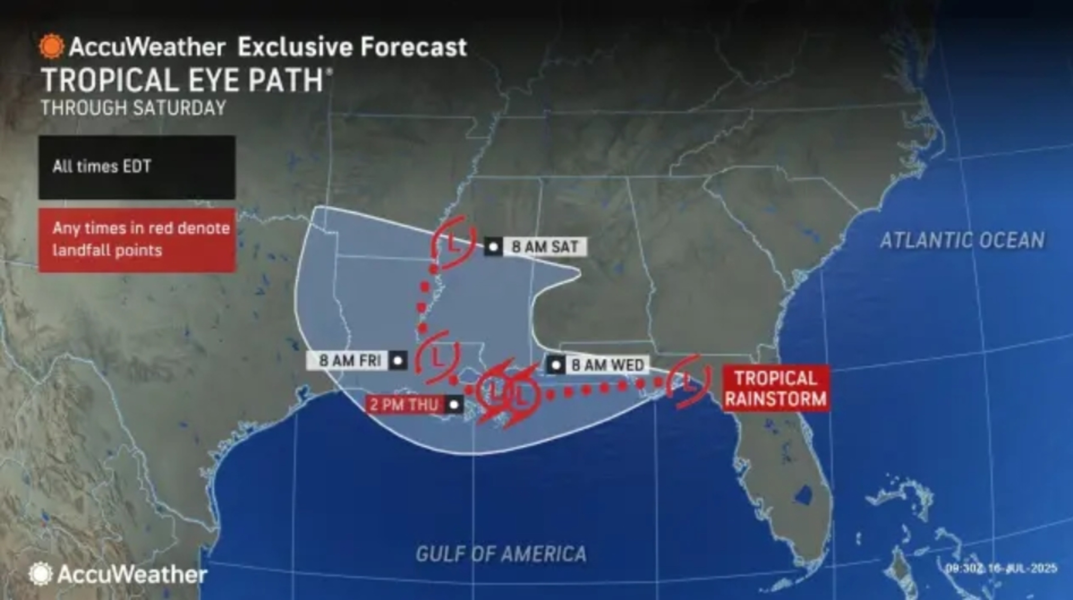
Tropical Storm Dexter’s Projected Path and Landfall Timing
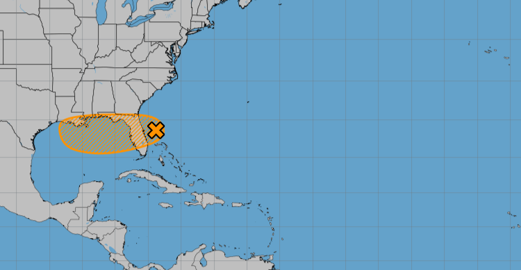
The developing tropical system, which may strengthen into Tropical Storm Dexter, is currently tracking westward across the Gulf Coast. Forecast models indicate a high probability of landfall near southeast Louisiana on Thursday afternoon, with impacts beginning as early as Wednesday evening. This slow-moving system brings elevated risks of prolonged rainfall and potential stalling over the region.
Key timeline details:
- Wednesday PM: Outer rainbands begin affecting coastal parishes
- Thursday 2-8PM: Projected landfall window with tropical-storm-force winds
- Friday: Peak flood risk as system potentially stalls
- Sunday: Final rainbands clear the area

Rainfall Predictions and Flood Risk Assessment
Meteorologists predict widespread rainfall totals of 6-8 inches across metro New Orleans, with isolated amounts potentially reaching 15 inches where training rainbands persist. The National Weather Service has issued:
| Alert Type | Area | Effective Until |
|---|---|---|
| Flood Watch | Entire SE Louisiana | Sunday evening |
| Level 3 Flood Risk | Orleans/Jefferson Parishes | Friday 8PM |
Most Vulnerable Neighborhoods
Based on historical flood patterns, these areas require special attention:
- Mid-City: Prone to street flooding due to aging infrastructure
- Lakeview: High risk of residential flooding
- Gentilly: Although improved, still susceptible
Emergency Preparations and Safety Measures
New Orleans officials recommend these critical preparations before Wednesday evening:
- Sandbags: Available at 5 city locations until supplies last
- Vehicle Protection: Move cars to elevated areas by Thursday noon
- Medical Needs: Refill prescriptions for 7-day supply
- Utilities: Know how to shut off gas/water if flooding occurs
Evacuation Considerations
While mandatory evacuations haven’t been ordered, voluntary evacuations may be recommended for:
- Residents outside levee protection
- Those in mobile homes/RVs
- People with medical equipment requiring electricity
Comparing Dexter to Historical New Orleans Storms
This event shares characteristics with several notable past storms:
| Storm | Rainfall | Flood Impact |
|---|---|---|
| May 1995 | 10-12 inches | 25,000 flooded homes |
| August 2023 | 9 inches in 6 hours | 800+ water rescues |
| Dexter Forecast | 6-15 inches/48hrs | Pending |

Infrastructure Improvements Since Katrina
While the $14 billion levee system upgrade provides better protection, drainage remains the primary concern with Dexter:
- New pumping stations can move 150,000 gallons/minute
- Outfall canals widened and fortified
- Remaining vulnerabilities in power reliability
Long-term Weather Outlook Post-Dexter
The storm’s lingering effects may include:
- Weekend: Gradual clearing with residual flooding
- Next Week: Return to typical summer storm pattern
- Seasonal: Increased vigilance through peak hurricane season
Residents should monitor official channels for real-time updates as Dexter’s path and intensity may change. Bookmark these essential resources:
- NWS New Orleans Twitter
- Ready.NOLA.gov
- Parish emergency alerts
Comments