
Hurricane Iona has intensified into a dangerous Category 3 storm as it charges westward across the central Pacific with 115 mph winds. The compact but powerful hurricane currently poses no direct threat to Hawaii, though its outer bands may bring breezy conditions to the islands.
Tropical Storm Keli has formed behind Iona but is expected to weaken soon, while forecasters monitor two new disturbances in the Eastern Pacific. Ocean heat content remains alarmingly high along Iona’s path, raising concerns about further intensification.
- Hurricane Iona has rapidly intensified into a major Category 3 storm with sustained winds of 115 mph, and could strengthen further to Category 4.
- Tropical Storm Keli has formed but poses no threat to Hawaii, expected to weaken soon in cooler waters.
- Two new disturbances in the Eastern Pacific are being monitored for potential tropical cyclone development, though no immediate impacts are expected.
- Iona’s compact wind field limits hurricane-force winds to just 20 nautical miles from its center, significantly reducing its widespread impact.
- Weather experts emphasize that neither Hurricane Iona nor Tropical Storm Keli currently threaten Hawaii, though dry breezy conditions may occur as Iona passes south of the islands.
Hurricane Iona Tracking Path: Latest Updates on Storm’s Strength, Pacific Disturbances, and Tropical Storm Keli
Hurricane Iona Intensifies to Category 3 With Potential for Further Strengthening
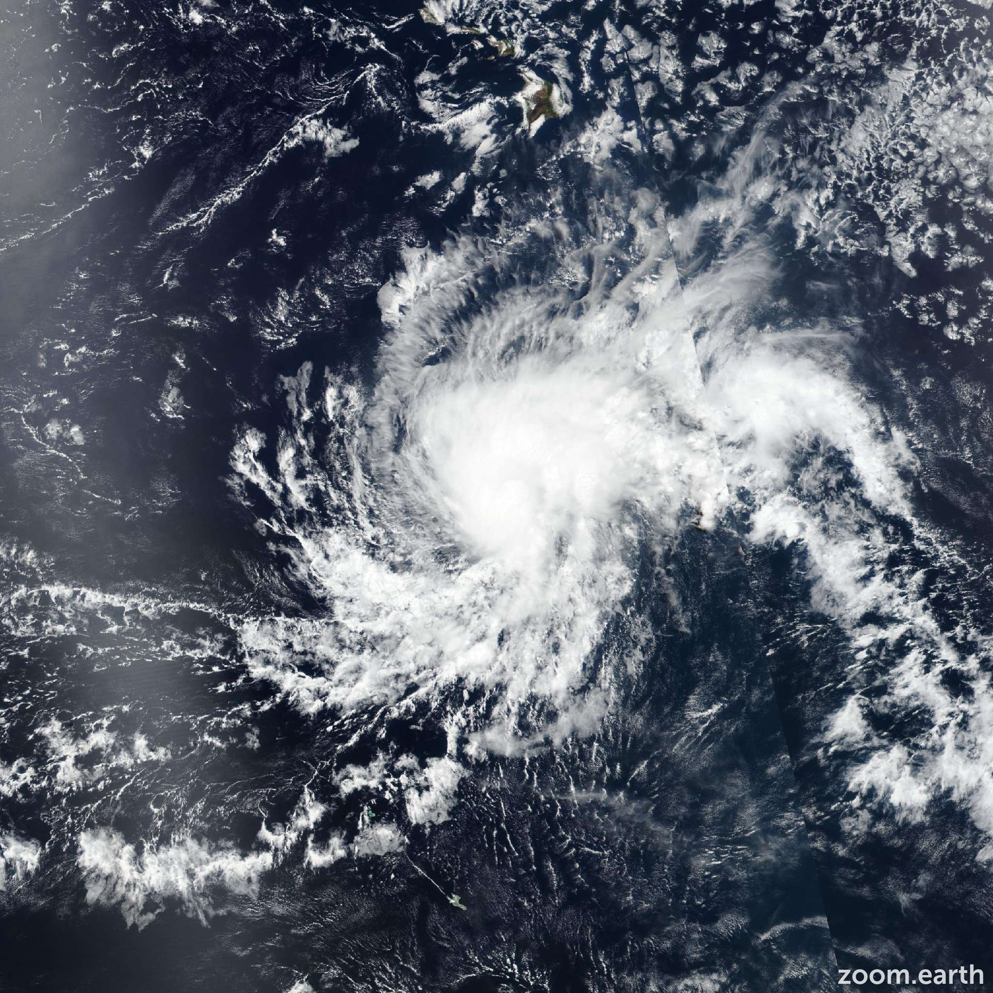
Hurricane Iona has rapidly intensified into a dangerous Category 3 storm with sustained winds of 115 mph, marking a significant escalation in the Pacific hurricane season. The National Hurricane Center reports the storm’s hurricane-force winds extend only 20 nautical miles from its compact center, creating a concentrated area of extreme winds. Meteorologists note the system shows all signs of continuing its intensification trend through today.
The rapid development caught many forecasters by surprise, with wind speeds increasing 60 mph in just 24 hours – characteristic of explosive deepening fueled by exceptionally warm ocean waters. Current satellite imagery reveals a well-defined eyewall and symmetrical structure, both indicators of a healthy, organizing storm.
- Current wind speed: 115 mph (Category 3)
- Central pressure: 957 mb (dropping)
- Movement: West at 10 mph
- Size: Compact core with concentrated winds

Factors Contributing to Iona’s Rapid Development
Three primary environmental factors are feeding Iona’s intensification:
| Factor | Current Measurement | Threshold for Rapid Intensification |
|---|---|---|
| Sea Surface Temperature | 29°C (84°F) | 26.5°C (80°F) |
| Ocean Heat Content | 120 kJ/cm² | 50 kJ/cm² |
| Vertical Wind Shear | 8 knots | <15 knots |
Current Tracking Path and Projected Movement Through the Pacific
As of the latest advisory, Hurricane Iona is located approximately 895 miles southeast of Honolulu, moving steadily westward at 10 mph. The forecast track shows the system maintaining this general motion for the next 72 hours, keeping it safely south of the Hawaiian Island chain.

The steering pattern is dominated by a strong subtropical high-pressure system north of Iona, a typical setup for July tropical cyclones in this region. Historical analogs suggest this track would parallel Hurricane Douglas in 2020, which passed about 200 miles north of Hawaii with minimal impacts.
Three key reasons Hawaii remains safe from direct impacts:
- The high-pressure shield maintains westward steering
- No significant troughs to pull the storm northward
- Storm’s compact nature limits outer wind impacts
Tropical Storm Keli: Formation, Trajectory and Expected Duration
While Hurricane Iona dominates attention, newly formed Tropical Storm Keli trails about 800 miles behind it in the central Pacific. With maximum sustained winds of 50 mph, Keli represents the second named storm of the Pacific season but isn’t expected to match Iona’s intensity.
Key differences between the two systems:
- Size: Keli has a broader wind field than compact Iona
- Environment: Cooler waters await Keli’s path
- Duration: Keli may only last 5 days vs Iona’s 10+ day journey
The joint typhoon warning center forecasts Keli to peak at 60 mph winds before encountering hostile conditions. Ships in the region should monitor maritime warnings, but like Iona, Keli poses no threat to land areas at this time.
Emerging Pacific Disturbances: Should Hawaii Residents Be Concerned?
Forecast teams are monitoring two areas of potential development in the Eastern Pacific that could become tropical cyclones next week. Neither shows immediate signs of organization, but their positions bear watching.

The first disturbance, dubbed Invest 98E by forecasters, shows:
- 30% chance of development in 48 hours
- Moderate wind shear of 15-20 knots
- Warm but not exceptional ocean temperatures
The second area further west appears less organized currently but bears monitoring given the active background state of the Pacific basin. Historical storm data suggests July systems that form in these locations typically curve harmlessly westward.
Scientific Analysis: Unpacking Iona’s Meteorological Exceptionalism
Hurricane Iona presents several unusual characteristics that merit deeper examination from the meteorological community. Its combination of small size and rapid intensification challenges some conventional understanding of tropical cyclones.
Three remarkable features:
- Compact Wind Field: Hurricane-force winds extend just 20 nautical miles from center (typically 50+ miles for major hurricanes)
- Pressure-Wind Relationship: Sustained winds exceed expected values for its central pressure
- Structural Stability: Maintains symmetric form despite small size
Researchers suggest climate change may be increasing the frequency of such “compact major hurricanes” – intense but spatially small systems that can be particularly dangerous due to their concentrated energy.
Historical Context: How Iona Compares to Past Pacific Hurricanes
While impressive, Iona isn’t unprecedented in Pacific hurricane history. Some notable comparisons:
| Hurricane | Year | Peak Intensity | Notable Characteristics |
|---|---|---|---|
| Patricia | 2015 | Category 5 | Most intense Pacific hurricane recorded |
| Iona | 2024 | Category 3 (possibly 4) | Compact size, rapid intensification |
| Douglas | 2020 | Category 4 | Close Hawaii approach |
This historical perspective shows that while Iona is noteworthy for its development rate, the Pacific basin routinely produces intense hurricanes – especially during developing El Niño conditions like we’re currently experiencing.
Comments