
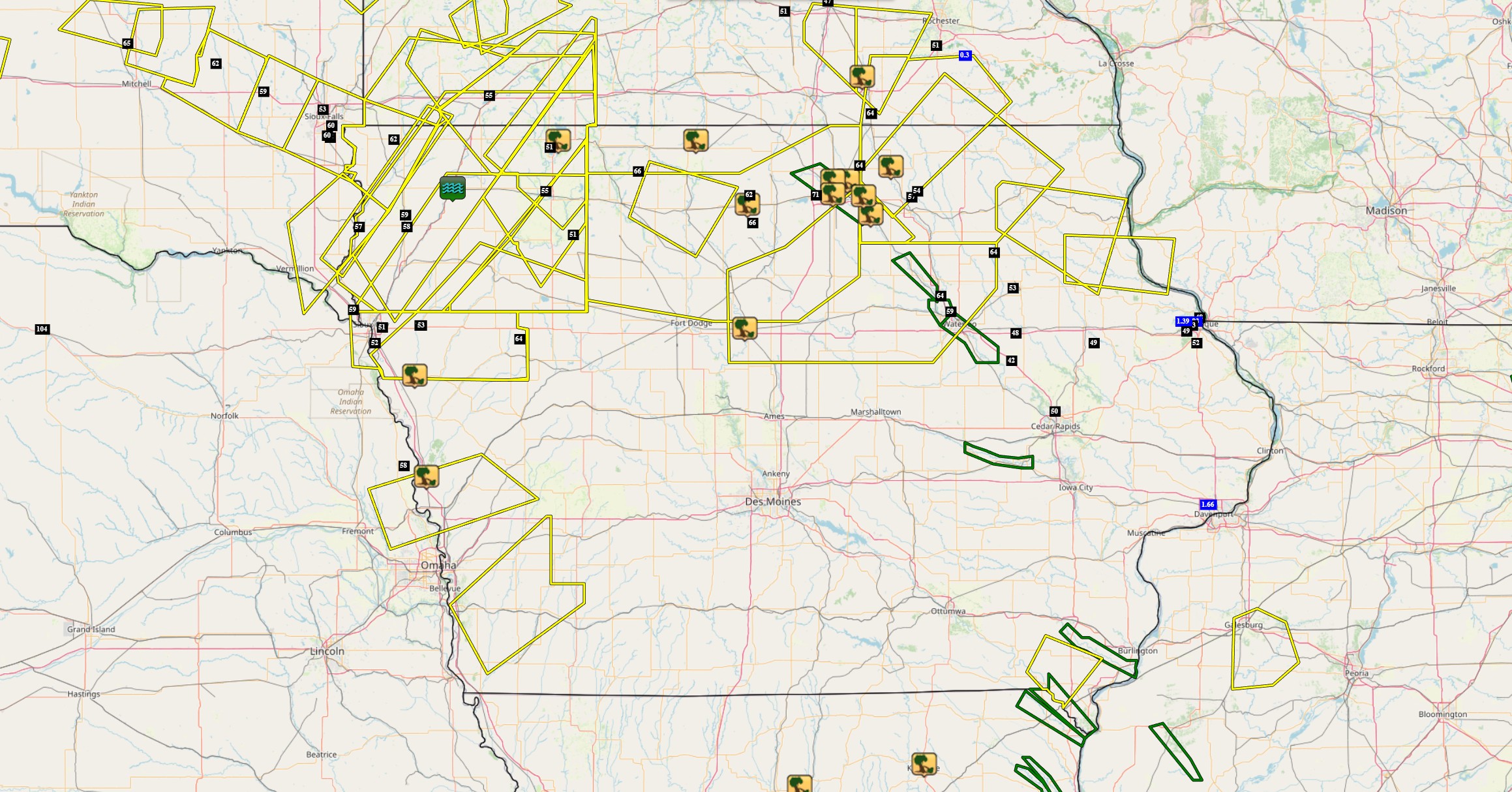
The Midwest faces renewed severe weather threats as Iowa braces for another potential derecho—a destructive windstorm capable of hurricane-force gusts. Recent storms have already left a trail of damage across South Dakota, Minnesota, and Iowa, with snapped trees and widespread power outages.
Meteorologists warn these conditions mirror patterns preceding previous derecho events, prompting urgent safety preparations. Residents are advised to review updated tornado protocols and emergency plans as the region enters peak severe weather season.
- The Midwest faces a potential derecho event with hurricane-force winds up to 99 mph, mirroring destructive weather patterns from late June.
- Updated tornado safety guidelines emphasize redundant alert systems and post-storm hazard awareness, with 63% of injuries occurring during post-impact movement.
- Utility companies report extended power outages across Iowa, with rural areas potentially waiting until August 7+ for restoration amid dangerous heat conditions.
Midwest Braces for Severe Weather Storms: Iowa Derecho Threat Intensifies

The Midwest is facing an escalating threat of severe weather storms, particularly in Iowa where meteorologists warn of potential derecho formation. These organized storm systems, characterized by hurricane-force straight-line winds exceeding 75 mph, could cause widespread damage similar to the July 29th event that left thousands without power. Current atmospheric conditions show disturbing parallels to derecho triggers from previous years, including a persistent heat dome over the central U.S. and temperature differentials exceeding 25°F between ground and upper air levels.
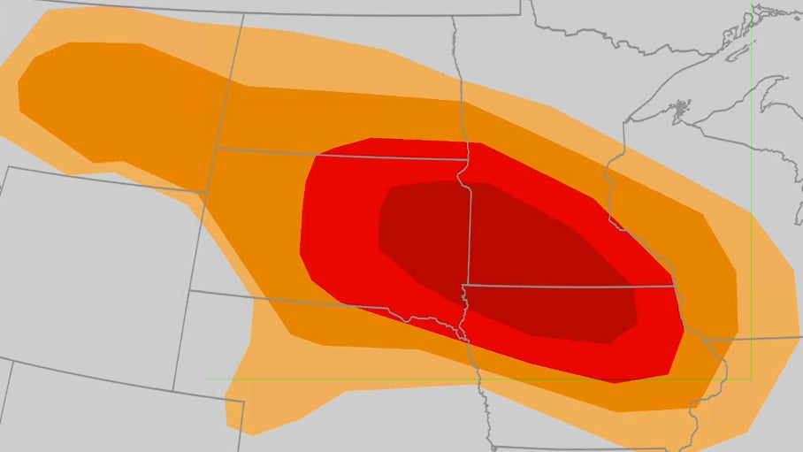
The National Weather Service has elevated parts of South Dakota, Iowa, and Minnesota to Level 4 severe weather risks, noting that recent soil saturation increases both flash flood potential and tree uprooting risks. Satellite imagery reveals developing convection patterns that historically precede derecho events, with bow echo formations appearing on radar – a telltale sign of organized wind damage potential.
- Current wind speed projections: 75-99 mph
- Peak threat window: Late afternoon through midnight
- Primary risk zone: 250-mile corridor from Nebraska to Wisconsin
Emergency management officials have revised tornado safety protocols following analysis of derecho-spawned tornado damage in South Dakota. The new recommendations specifically address risks unique to these embedded tornadoes, which often form unexpectedly within larger windstorms. Key updates include:
- Hard-soled shoes in emergency kits (63% of injuries occurred during post-storm movement)
- Identification of secondary shelters when basements are inaccessible
- Three-alert verification system combining WEA, NOAA radio, and local sirens

| Utility Provider | Outages Remaining | Est. Restoration |
|---|---|---|
| MidAmerican Energy | 47,800 | August 3 |
| Alliant Energy | 32,150 | August 5 |
| Rural Co-ops | 18,200 | August 7+ |
Transmission line damage remains the primary restoration challenge, with some rural areas needing complete pole replacements. The simultaneous heat wave compounds risks for vulnerable populations, prompting emergency cooling station openings in 17 counties.
[h2]Decoding Storm Cloud Formations: What That Eerie Shelf Cloud Means[/h2]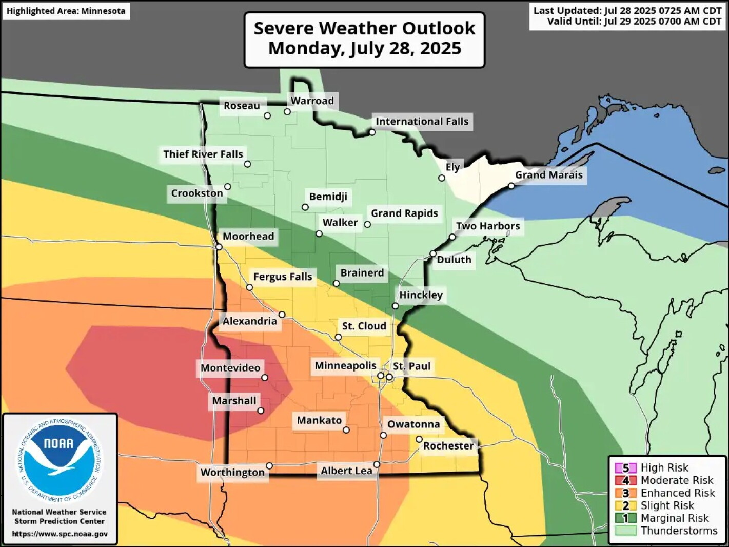
The ominous shelf clouds preceding recent derechos form through specific mechanisms:
- Gust front dynamics: Cold air outflow creates rolling cloud formations
- Lifted condensation levels: Depression creates unusually low cloud bases
- Wind shear patterns: Produces characteristic wave-like appearance
Chaser footage reveals critical derecho behaviors:
- Wind speeds spiking 40+ mph in under 5 minutes
- Microburst clustering that amplifies damage
- Distinctive “wind row” tree fall patterns proving straight-line winds
Comparative footage shows crop damage divergences between tornado swirl patterns (circular) versus derecho flattening (uniform directional collapse).
[p-subheading]Scientific Storm Analysis[/p-subheading]Historical Derecho Patterns in the Midwest
Climate data reveals derechos cluster during specific conditions:
| Year | Peak Month | Max Wind Speed |
|---|---|---|
| 2020 | August | 140 mph |
| 2013 | July | 94 mph |
| 2025 | July-August | 99 mph (projected) |
Essential Storm Survival Kit Checklist
- Hard-soled shoes (kept with kit)
- battery-powered weather radio
- Medications (7-day supply)
- Emergency contact list (physical copy)
Crop Damage Assessment After Recent Storms
Early surveys show:
- Corn: 38% flattening in worst-hit counties
- Silo damage: 217 reported collapses
- Grain storage loss: Estimated $47 million
Comments