
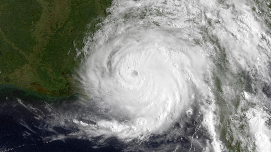
Hurricane Erin has intensified to a Category 3 storm, barreling toward the East Coast with Rockaway Beach bracing for potentially catastrophic impacts. The National Hurricane Center warns of life-threatening storm surges, 12-foot waves, and dangerous rip currents along coastal areas from North Carolina to New England.
Residents in evacuation zones are urged to prepare immediately as the storm’s outer bands begin lashing the shoreline. Current projections show peak impacts hitting Rockaway between August 20-21, with flooding expected across 70% of the peninsula during high tides.
- Hurricane Erin has intensified to a Category 3 storm with 120 mph winds, posing severe threats to Rockaway and the East Coast through dangerous surf, coastal flooding, and life-threatening rip currents.
- Peak impacts are expected between August 20–21, with Rockaway Beach facing 8-12 foot waves and potential flooding in 60-70% of the peninsula during high tides.
- Evacuation protocols are activated for Zone A areas, as Erin’s unpredictability leaves a 30-mile westward deviation risk of hurricane-force winds hitting Rockaway directly.
- Comparisons to historic storms like Sandy (2012) highlight Erin’s faster intensification and prolonged impacts, with residual erosion and rip currents lasting through the weekend.
Hurricane Erin Threatens Rockaway: Current Situation and Immediate Dangers
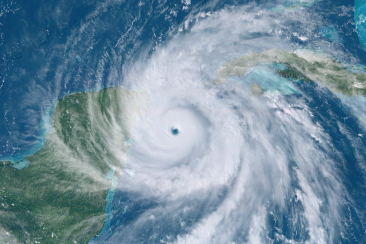
Hurricane Erin has rapidly intensified into a major Category 3 storm as it barrels toward the East Coast, with Rockaway Beach directly in its path. As of August 20, 2025, the storm’s sustained winds have reached 120 mph, creating extremely dangerous conditions for coastal communities. The National Hurricane Center has issued tropical storm warnings from North Carolina to Massachusetts, emphasizing the life-threatening nature of the approaching storm surge.
Local authorities in Rockaway have begun implementing emergency protocols, including beach closures and preparations for potential evacuations. The combination of high winds and massive waves poses exceptional risks to infrastructure and public safety. Residents are being warned to expect:
- Coastal flooding of 4-6 feet in New York Harbor
- Destructive waves reaching 8-12 feet
- Power outages from strong winds
- Severe beach erosion

Tracking Hurricane Erin: Latest Path Projections and Movement
Meteorologists report Hurricane Erin is currently moving north-northeast at 14 mph about 200 miles east of Rockaway Beach. The storm’s predicted path shows it will ride parallel to the coastline before making a sharp turn eastward. However, slight deviations in this forecast could dramatically impact land areas:
| Time Frame | Expected Position | Potential Impact |
|---|---|---|
| August 20 Evening | 200 miles SE of Rockaway | Dangerous surf begins |
| August 21 Morning | 150 miles E of NYC | Peak storm conditions |
| August 22 Afternoon | Moving NE away from coast | Gradual improvement |
Comparison to Historical Storms
Hurricane Erin shares characteristics with two devastating past storms:
- Storm surge potential similar to Hurricane Sandy (2012)
- Wind intensity matching Hurricane Isabel (2003)
- Rapid intensification exceeding both historical storms
Preparing Rockaway for Hurricane Erin: Evacuation Zones and Safety Measures
New York City officials have activated Zone A evacuation protocols for Rockaway and other vulnerable areas. The projected storm surge could flood 60-70% of the Rockaway peninsula during peak high tides. Residents are being advised to:
- Prepare emergency kits with 3 days of supplies
- Identify evacuation routes and shelter locations
- Secure property against potential flood damage
- Monitor NYC Emergency Management alerts
Projected Timeline: When Hurricane Erin Will Impact East Coast Areas
The most dangerous conditions are expected along this schedule:
| Location | Dangerous Begins | Peak Conditions |
|---|---|---|
| Rockaway Beach | Aug 20, 6PM | Aug 21, 8AM |
| Atlantic City | Aug 20, 4PM | Aug 21, 6AM |
| Outer Banks | Aug 20, 2PM | Aug 20, 10PM |
Expected Durations of Key Impacts
Residents should prepare for these conditions to last:
- Dangerous surf: 24-36 hours
- Strong winds: 18-24 hours
- Coastal flooding: Multiple high tide cycles
- Power outages: Potentially several days
Community Response in Rockaway: Preparations Underway
Local residents share varied reactions:
- “We’re boarding up and evacuating – better safe than sorry”
- “After Sandy, we know the drill – just hoping it’s not as bad”
- “Waiting to see if it veers east before making final decisions”
Forecasting the Aftermath: Recovery Expectations Post-Erin
Authorities anticipate these recovery challenges:
- Beach erosion repairs lasting months
- Electrical infrastructure restoration
- Road and transit system repairs
- Environmental cleanup from floodwaters

Long-Term Climate Considerations
Experts note increasing hurricane intensity aligns with:
- Warmer ocean temperatures
- Changing weather patterns
- Rising sea levels exacerbating storm surges
Comments