A flash flood warning has been issued for Los Angeles as heavy rainfall threatens to trigger dangerous flooding and mudslides across the region. Emergency officials urge residents to prepare for rapidly changing conditions, especially in mountainous areas and recent burn scars.
Life-threatening flooding is possible with rainfall rates exceeding 0.5 inches per hour, particularly near streams and low-lying areas. The National Weather Service warns that even small creeks can become deadly torrents with little warning.
This article covers critical safety information, high-risk zones, and how long the severe weather is expected to last. Residents should monitor local alerts and avoid flood-prone roads.
- Flash flood warning issued for Los Angeles County, effective until Saturday evening with heavy rainfall expected through Sunday morning.
- High-risk areas for mudslides include Lake Elizabeth, areas north of Castaic, and canyon communities near recent burn scars.
- Residents urged to avoid flooded streets, move to higher ground, and check LA County Public Works website for real-time danger zone maps.
- Emergency sandbags available at fire stations, county maintenance yards, and community centers across flood-prone areas.
- Expected rainfall ranges from 2-4 inches in coastal areas to 6-10 inches in mountainous regions, with potential road closures and power outages.
Flash Flood Warning Los Angeles: Duration, High-Risk Areas for Mudslides, and Safety Tips
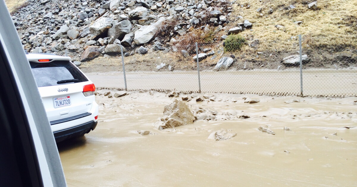
Current Flash Flood Situation in Los Angeles County
The National Weather Service has extended the flash flood warning for Los Angeles County through Sunday evening as an atmospheric river continues dumping heavy rainfall across Southern California. Rainfall rates exceeding 0.75 inches per hour have been recorded in the Santa Monica Mountains, creating dangerous runoff conditions in vulnerable areas.
Several rescues have already been conducted in Studio City and Tarzana where vehicles became trapped in rapidly rising waters. Emergency management officials report that 911 call volume has tripled since the storm began, with most calls related to flooded basements and stalled vehicles.

Hour-by-Hour Forecast for Critical Areas
The most dangerous conditions are expected during these time frames:
- Saturday 10PM – Sunday 2AM: Peak rainfall intensity for coastal valleys
- Sunday 5AM – 10AM: Highest mudslide risk for burn scar areas
- Sunday Noon – 6PM: Potential for urban street flooding
Highest Risk Neighborhoods for Mudslides and Debris Flows
The following communities face extremely dangerous conditions due to recent wildfires:
| Area | Risk Level | Evacuation Status |
|---|---|---|
| Tujunga Canyon | Extreme | Mandatory Evacuation |
| Topanga Canyon | High | Voluntary Evacuation |
| La Tuna Canyon | Extreme | Mandatory Evacuation |

Essential Safety Measures During Flash Floods
When facing imminent flood danger, follow these life-saving protocols:
- Immediately move to higher ground if you hear rushing water or see water levels rising rapidly
- Never attempt to walk or drive through flood waters – just six inches can knock over an adult
- Disconnect electrical appliances in basements or ground floors
- Fill bathtubs with clean water in case service interruptions occur
Most flash flood deaths occur when people ignore barricades and attempt to drive through flooded roadways. Nearly half of these fatalities involve vehicles being swept away.
Road Closures and Transportation Impacts
Major transportation disruptions currently affecting Los Angeles County:
- Pacific Coast Highway closed between Topanga Canyon and Malibu
- Multiple lane closures on I-5 through the Grapevine
- Metro Rail experiencing delays on multiple lines due to signal issues
- LAX operating normally but advises passengers to allow extra travel time
Alternative Transportation Options
For those needing to travel during the storm:
- Check Metro’s real-time service alerts before departing
- Consider teleworking options if possible
- Have emergency supplies in your vehicle if travel is essential
Where to Find Emergency Resources and Updates
Reliable information sources during the crisis:
| Service | Contact Method |
|---|---|
| LA County Emergency Alerts | Text “READY” to 888-777 |
| Sandbag Locations | Call 211 or visit ready.lacounty.gov |
| Road Conditions | Caltrans QuickMap or call 1-800-427-7623 |

Long-Term Weather Outlook Beyond the Flood Warning
While the immediate flash flood warning expires Sunday evening, meteorologists caution about ongoing risks:
- Saturated soils increase landslide potential for 72 hours after rainfall ends
- Damaged infrastructure may take weeks to fully repair
- Additional storm systems forecast for next weekend
Climate Change Connection
The increasing frequency of these extreme rainfall events matches climate models predicting:
- More intense but less frequent precipitation
- Longer dry periods between storms
- Higher proportion of rain versus snow in mountain areas
Comments