
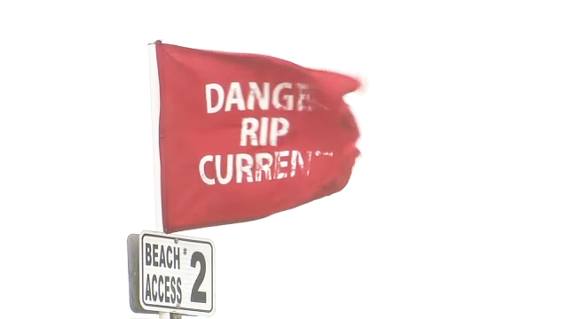
Wildwood, NJ beaches are under critical restrictions today as Hurricane Erin generates deadly rip currents along the Jersey Shore. Officials have implemented a full swimming ban with red flags flying at all beach access points.
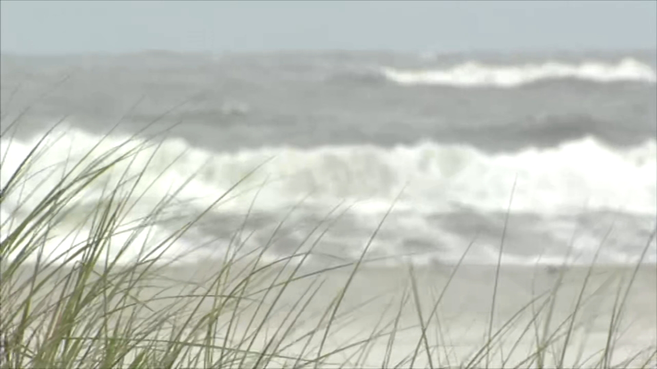
The Wildwood Beach Patrol reports 6-10 foot waves and rapidly changing tides creating life-threatening conditions, even for experienced swimmers. While the sand remains open, visitors face strict water entry limitations and reduced lifeguard presence.
“These are the most dangerous surf conditions we’ve seen this season,” warns Chief Steve Stocks, noting 12 water rescues since Monday. Forecasters expect hazardous waves to persist through Friday, with gradual improvement possible by weekend.
- Wildwood, NJ beaches are closed for swimming due to life-threatening rip currents from Hurricane Erin, with red flags posted and lifeguards on high alert.
- Beach erosion and coastal flooding are intensifying, with waves reaching 6-10 feet and emergency responders conducting multiple rescues daily.
- Officials project the swimming ban may last until August 23, pending improvements in wave height (<4ft) and rip current risk (low/moderate).
- Alternative activities include storm watching, indoor waterparks, and museum visits, though beach walking is permitted with strict 50-foot buffer zones from water.
- Climate change impacts are evident as Erin maintains strength unusually far north, with warmer coastal waters prolonging dangerous conditions.
Wildwood NJ Beach Closure: Dangerous Rip Currents from Hurricane Erin Force Swimming Ban
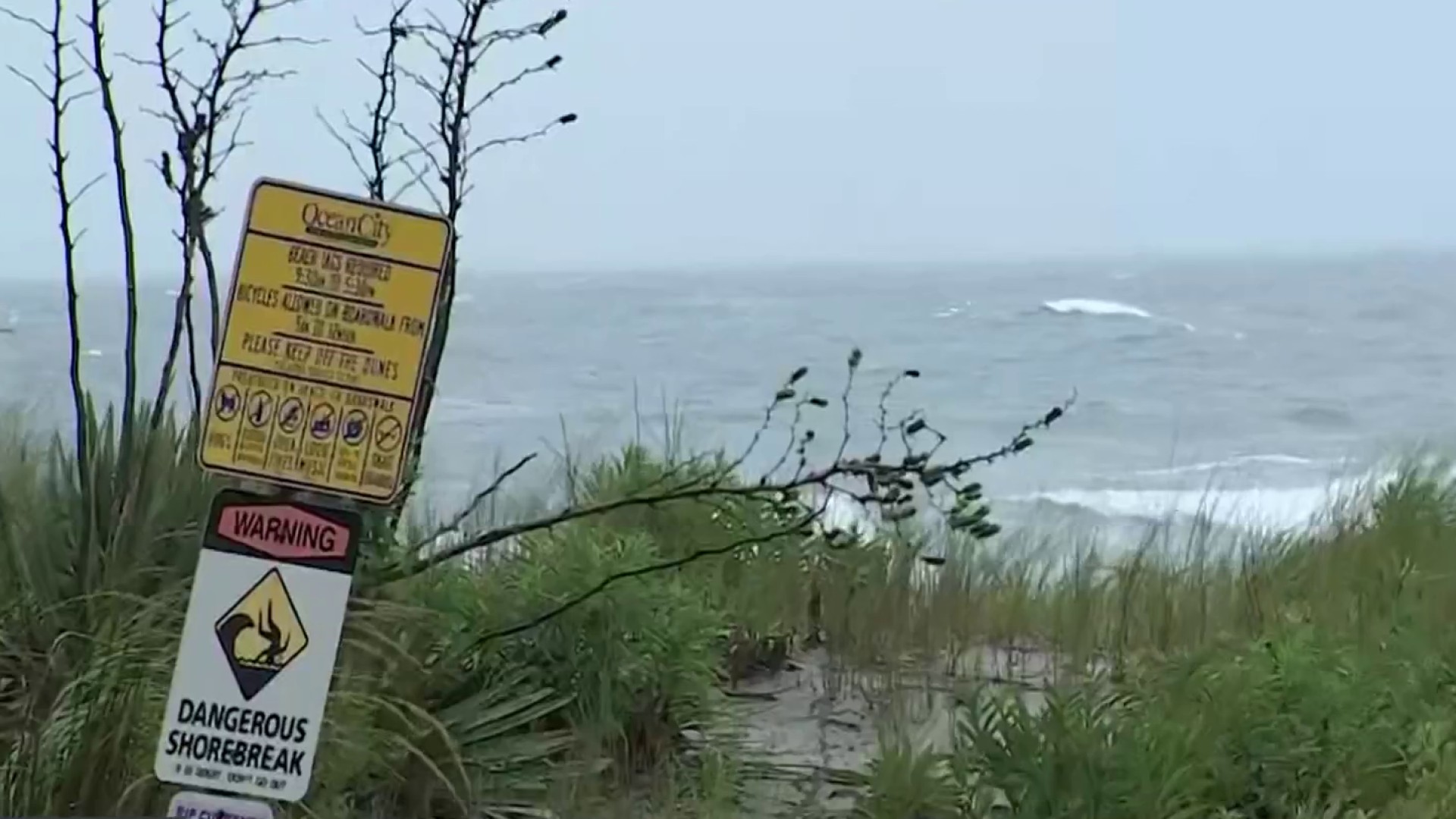
Wildwood, New Jersey has implemented emergency beach closures today as Hurricane Erin generates life-threatening rip currents along the coast. The National Weather Service has issued a high risk rip current warning through Friday, with waves reaching 6-10 feet and creating perilous swimming conditions. Lifeguards have removed all stands from the shoreline and erected red warning flags at every beach access point.
Key restrictions currently in place:
- Complete prohibition on swimming and wading beyond ankle depth
- No inflatable devices allowed on beaches
- 50-foot buffer zone enforced between visitors and waterline
- Beach tags still required despite swimming ban
Coastal geologists report the storm has already caused significant sand loss along Wildwood’s beaches, with some areas losing up to 15 feet of dune elevation since Monday. Emergency services have conducted 14 water rescuses in the past 48 hours, prompting officials to declare this the most dangerous surf event of the 2025 season.

Why This Closure Differs from Normal Red Flag Conditions
The current restrictions exceed standard red flag warnings because:
- Simultaneous occurrence of spring tides and hurricane swell
- Unusually long duration of dangerous conditions (4+ days)
- Multiple rip current formations per 100 yards of beach
- Visibility reduced to less than 2 feet in turbulent water
Hurricane Erin’s Path and Expected Timeline for Wildwood

As of 11AM EST August 22, Hurricane Erin continues moving northeastward approximately 200 miles offshore, maintaining Category 2 strength with sustained winds of 105 mph. While the storm won’t make direct landfall in New Jersey, its expansive wind field (spanning 300+ miles) ensures continued coastal impacts through the weekend.
Projected timeline for Wildwood:
| Date | Wave Height | Rip Current Risk | Beach Status |
|---|---|---|---|
| Aug 22 (Today) | 6-10 ft | Extreme | Closed |
| Aug 23 | 4-7 ft | High | Closed |
| Aug 24 | 3-5 ft | Moderate | Restricted |
How to Identify and Survive Rip Currents at Wildwood
Rip currents at Wildwood are displaying several distinctive characteristics during this event:
- Milky, sediment-filled water flowing seaward between breaking waves
- Noticeable gaps in incoming wave patterns
- Foam or debris moving steadily offshore
- Discolored water channels 10-30 feet wide
If caught in a rip current:
- Stay calm and conserve energy (don’t fight the current)
- Float or tread water while signaling for help
- Swim parallel to shore to escape the narrow current
- Only attempt direct shore swimming if the current weakens
Beach Erosion and Environmental Impacts

Hurricane Erin has accelerated erosion issues along Wildwood’s coastline, with concerning developments:
- 15-20 foot vertical drop-offs forming along high tide lines
- Exposed septic systems and utility infrastructure
- Destruction of recently replenished beach areas
- Loss of protective dune vegetation
The storm’s persistent northeast winds have created an alongshore current that’s transporting sand southward at an estimated rate of 50,000 cubic yards per day. This exceeds normal seasonal erosion by nearly 400% according to USGS measurements.
Long-Term Climate Concerns
Scientists note three alarming trends exacerbating Wildwood’s erosion crisis:
- Sea level rise accelerating to 5mm/year in Delaware Bay
- Increased frequency of northeasterly storm winds
- Warmer ocean temperatures extending hurricane season
Alternative Activities During the Beach Closure
While the ocean remains off-limits, visitors can still enjoy numerous safer alternatives:
Storm Observation
Designated viewing areas with proper precautions:
- North Wildwood jetty (concrete platform)
- Second Avenue storm wall (elevated walkway)
- Boardwalk observation decks
Indoor Attractions
- Wildwoods Convention Center exhibits
- Cape May County Museum hurricane history display
- Surfside Pier arcade and indoor mini-golf
Emergency Contacts and Safety Resources
Important numbers for visitors:
| Service | Contact | Notes |
|---|---|---|
| Beach Patrol Emergency | 609-522-8255 | Direct line for water rescues |
| Coast Guard Station | 609-886-7924 | Marine emergencies |
| Weather Updates | #933 on mobile | NWS briefings |
Sign up for Cape May County emergency alerts at CMCalert.org for real-time closure updates and evacuation notices. Beach access points now feature QR codes linking to current conditions.
Comments